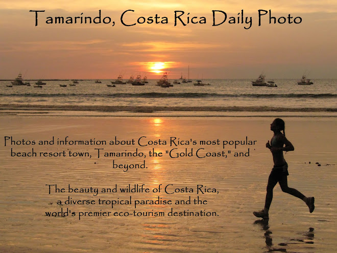

The large white building is the Pacific Park condo in the center of Tamarindo. The Diria Resort condos, where we have one of our two condos, is the building right behind the trunk of the tree on the right. A few condos in Playa Langosta, where we have our other condo, are visible along the tree line in the distance at the top center of the photo.
If the country continues the density and height controls that were adopted a few years ago, the area will remain mostly green. The real estate market is starting to improve, so the pause on new construction of the past 5 years or so might be interrupted by some new condo units. We will have to see whether the developers are successful in pre-selling units and getting their buildings under construction.
We are showing more photos from Julie's recent raft trip through the Grand Canyon on our Viva la Voyage travel photo site it. It is a unique place.

5 comments:
My fervent wish for the natives of Tamarindo is that developers are sensitive to the environment.
There is certainly a wonderful view from this hill you are on.
The big tall white building looks kind of out of place with all that green. That view is so pretty!
Nice shot from up there.
There sure is a lot of green. The city fathers probably recognize that their success is tied to retaining the natural feeling. It is easier to set strong controls before it gets too built up than to let things get out of control and then try to rein the developers back in. Good luck!
Post a Comment