It occurred to me that I have shown lots of photos of sunsets and ocean views from our condo right on the beach in the Playa Langosta area of Tamainrdo, but I have not shown many photos of the view from our condo at the Tamarindo Diria Resort in the middle of Tamarindo.
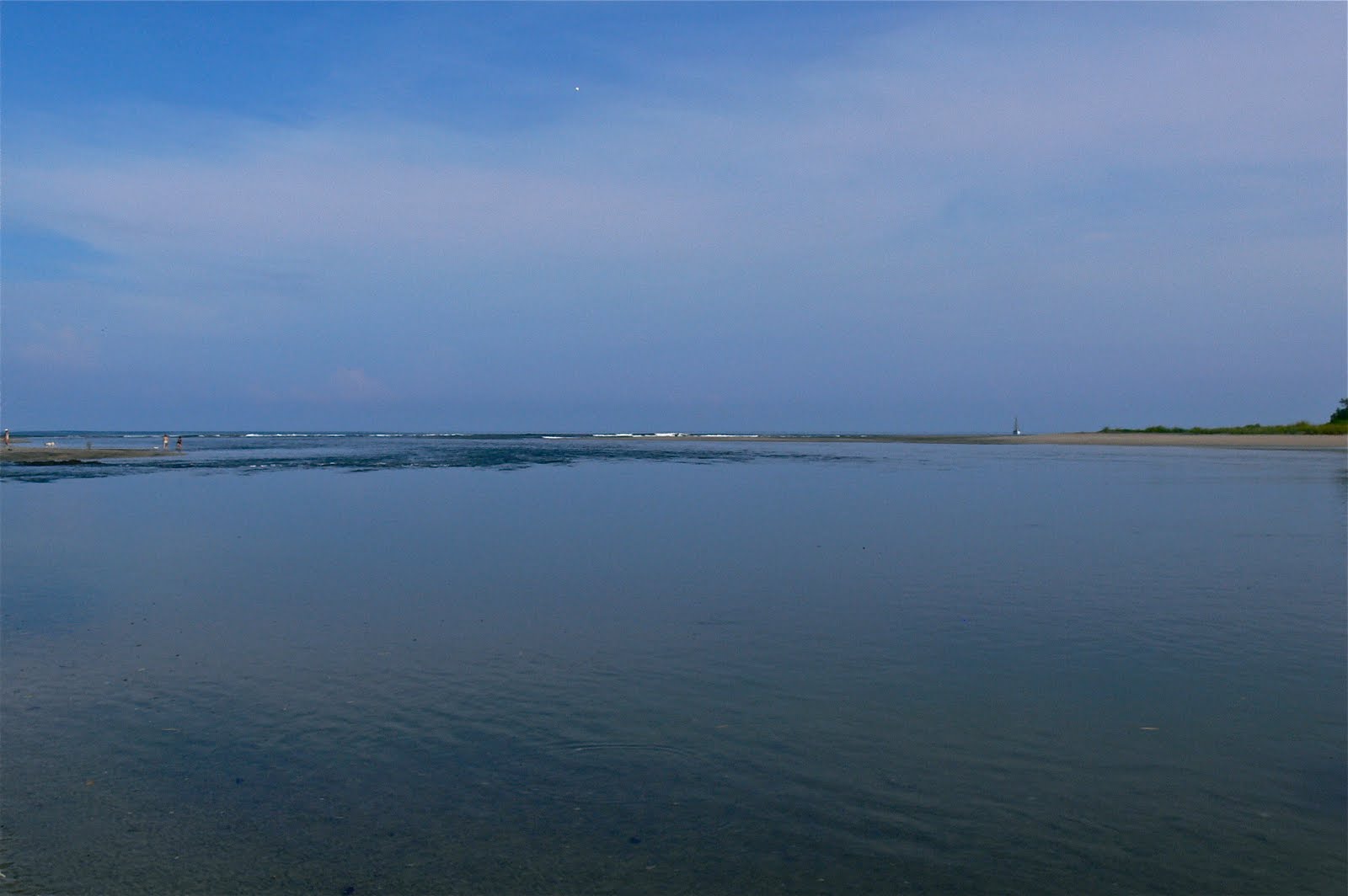
Today I will start a little series to cure that oversight. This is a photo from our condo balcony looking north across the mouth of the Tamarindo estuary towards Playa Grande.
The trees in the foreground are part of the grounds of the Tamarindo Diria Resort.
The main part of Tamarindo beach is straight out to the ocean to the left of this scene, but I like the view to the north as well. I will show the view to the west tomorrow and in the coming days.
Yesterday was a holiday in Guanacaste, the northwest province of Costa Rica. It was not a national holiday. It was Annexation Day, celebrating the vote on July 25, 1824 during which Guanacaste voted to be a part of Costa Rica rather than Nicaragua. Thank goodness.
This week we are showing some photos of Paris, featuring several of its museums. on our Viva la Voyage travel photo site.
Showing posts with label Tamarindo Estuary. Show all posts
Friday, July 26, 2013
Tuesday, July 24, 2012
Houses overlooking the estuary and ocean
Here is a closer view of the houses on the ridge overlooking the estuary. These houses will also have a nice view of Playa Grande and the ocean, which is just around the bend in the estuary to the right.
Developers like to build houses on the hills overlooking the Pacific, as people love to have homes and condos with an ocean view.
This week we have more photos of Julie's raft trip through the Grand Canyon on our Viva la Voyage travel photo site.
Developers like to build houses on the hills overlooking the Pacific, as people love to have homes and condos with an ocean view.
This week we have more photos of Julie's raft trip through the Grand Canyon on our Viva la Voyage travel photo site.
Labels:
Housing and condos,
Tamarindo Estuary
Monday, July 23, 2012
Leaving the Tamarindo Estuary
We are now heading back out of the Tamarindo Estuary. As wild and jungle-like as are the scenes of the mangrove swamps that I have shown during the past week or so, you can see from this photo how close we are to "civilization." Those are some of the houses of Tamarindo on the ridge overlooking the estuary.
In fact, the estuary is very close to the little Tamarindo airport, which has commuter flights from San Jose. The land around the airport is owned by the Diria Resort Group and they have plans to develop a golf course and homes in the area. They will leave the estuary in its natural state, as its ecology is protected.
This week we have more photos of Julie's raft trip through the Grand Canyon on our Viva la Voyage travel photo site.
In fact, the estuary is very close to the little Tamarindo airport, which has commuter flights from San Jose. The land around the airport is owned by the Diria Resort Group and they have plans to develop a golf course and homes in the area. They will leave the estuary in its natural state, as its ecology is protected.
This week we have more photos of Julie's raft trip through the Grand Canyon on our Viva la Voyage travel photo site.
Sunday, July 22, 2012
Mangrove reflections
This is another view that shows that the Tamarindo estuary's mangrove swamp is suitable only for wildlife habitat and wetlands for water runoff storage.
In the USA, 50 years ago the Army Corps of Engineers probably would have built a levee lining the estuary to prevent the water from flowing into the swamp so that the land behind the levee could be used for agriculture or developed for housing. The "channelization" the Mississippi River has caused higher floods even when there is less volume of water.
It is better to leave wetlands in the natural state, and to allow flood waters to flow into land that accommodates the high water times, other than to protect already populated areas, where people built in the flood plain before people and government had the wisdom to leave flood plains in their natural state.
Today is Sunday, so we have new photos on our Viva la Voyage travel photo site. This week we are showing some photos of the menthol blue waters of the Colorado River at the bottom of the Grand Canyon.
In the USA, 50 years ago the Army Corps of Engineers probably would have built a levee lining the estuary to prevent the water from flowing into the swamp so that the land behind the levee could be used for agriculture or developed for housing. The "channelization" the Mississippi River has caused higher floods even when there is less volume of water.
It is better to leave wetlands in the natural state, and to allow flood waters to flow into land that accommodates the high water times, other than to protect already populated areas, where people built in the flood plain before people and government had the wisdom to leave flood plains in their natural state.
Today is Sunday, so we have new photos on our Viva la Voyage travel photo site. This week we are showing some photos of the menthol blue waters of the Colorado River at the bottom of the Grand Canyon.
Wednesday, July 11, 2012
Narrower reaches of the mangrove swamp
Although the estuary is wide near the ocean, it extends with narrow fingers into the mangrove swamp. The tour boats travel to the upper reaches of the estuary to let people see the mangrove thickets up close.
They also stop so people can take a hike on some of the trails that lace through this natural habitat.
25% of the area of Costa Rica is set aside in national parks and wildlife refuges, the highest percentage of any country on earth. That is a primary reason, along wit the biodiversity, that ecotourism is the number one industry in the country.
We are showing photos of Bangkok, Thailand on our Viva la Voyage travel photo site this week. We loved it, and we hope you will enjoy our photos.
They also stop so people can take a hike on some of the trails that lace through this natural habitat.
25% of the area of Costa Rica is set aside in national parks and wildlife refuges, the highest percentage of any country on earth. That is a primary reason, along wit the biodiversity, that ecotourism is the number one industry in the country.
We are showing photos of Bangkok, Thailand on our Viva la Voyage travel photo site this week. We loved it, and we hope you will enjoy our photos.
Tuesday, July 10, 2012
Mangroves in a tidal estuary
This is a little closer view of the structure of mangrove trees in a tidal estuary. The roots take hold in the shallow sand bar, but there are no leaves below the high water line. The tide flows in and out under the tree.
The tree provides habitat for wildlife, as I will show in my posts in the next week or so.
These wetlands are also important areas for water runoff during the rainy season.
We are showing photos of Bangkok, Thailand on our Viva la Voyage travel photo site this week. We loved it, and we hope you will enjoy our photos.
The tree provides habitat for wildlife, as I will show in my posts in the next week or so.
These wetlands are also important areas for water runoff during the rainy season.
We are showing photos of Bangkok, Thailand on our Viva la Voyage travel photo site this week. We loved it, and we hope you will enjoy our photos.
Monday, July 9, 2012
Tamarindo estuary mangrove reflections
I took one of the little boats in yesterday's post on an excursion up the Tamarindo estuary, on the north edge of town. This is a protected area, as it is part of the Las Baulas National Marine Park. These are mangrove trees that line the estuary shores.
Tamarindo is separated on the north and south by the Tamarindo estuary and the Langosta estuary. This makes the area sort of like a peninsula as far as access from the rest of the area, as there is no direct access to the land across the estuaries.
We are showing photos of Bangkok, Thailand on our Viva la Voyage travel photo site this week. We loved it, and we hope you will enjoy our photos.
Tamarindo is separated on the north and south by the Tamarindo estuary and the Langosta estuary. This makes the area sort of like a peninsula as far as access from the rest of the area, as there is no direct access to the land across the estuaries.
We are showing photos of Bangkok, Thailand on our Viva la Voyage travel photo site this week. We loved it, and we hope you will enjoy our photos.
Sunday, July 8, 2012
Mouth of the Tamarindo Estuary
This is the entrance of the Tamarindo estuary, on the north edge of town. It is part of the Las Baulas National Marine Park. These little boats take tourists up into the estuary. It is a nice exposure to the ecology of a tropical mangrove estuary.
Across the estuary is Playa Grande, and the beach there is part of the National Park because it is the main nesting site for the Pacific Leatherback turtles. They swim from the area around the Galapagos Islands all the way to Tamarindo Bay to lay their eggs at Playa Grande.
There is a major controversy trying to prevent development near the beach at Playa Grande. The lights from development are considered detrimental to the turtles nesting. A recent article in the Tico Times, the leading English language newspaper, predicted declining leatherback turtle populations. During October - March the park rangers will lead small groups in the evening to sit on the beach in the dark at night to wait for turtles to come ashore.
My niece, who is getting her Ph.D. in marine biology, received a Watson Fellowship and spent a year studying sea turtles and the impact on the local communities from people changing from eating turtles to the benefits of ecotourism from visitors who want to see the turtles. She spent several months each on Cayman, South Africa, Australia, Indonesia, and Panama.
Across the estuary is Playa Grande, and the beach there is part of the National Park because it is the main nesting site for the Pacific Leatherback turtles. They swim from the area around the Galapagos Islands all the way to Tamarindo Bay to lay their eggs at Playa Grande.
There is a major controversy trying to prevent development near the beach at Playa Grande. The lights from development are considered detrimental to the turtles nesting. A recent article in the Tico Times, the leading English language newspaper, predicted declining leatherback turtle populations. During October - March the park rangers will lead small groups in the evening to sit on the beach in the dark at night to wait for turtles to come ashore.
My niece, who is getting her Ph.D. in marine biology, received a Watson Fellowship and spent a year studying sea turtles and the impact on the local communities from people changing from eating turtles to the benefits of ecotourism from visitors who want to see the turtles. She spent several months each on Cayman, South Africa, Australia, Indonesia, and Panama.
Today is Sunday, so we have new photos on our Viva la Voyage travel photo site. This week we are showing photos of Bangkok, Thailand, which dazzled us with its temples and the bustle of the city during our recent visit. We loved it, and we hope you will enjoy our photos.
Labels:
Activities for visitors,
Tamarindo Estuary
Tuesday, October 26, 2010
Surf lessons on Tamarindo Beach
If you are going to advertise surf lessons, what better signage than to plant a sign shaped like s surfboard and plant it in the sand?
We have photos of the red rock formations of Sedona, Arizona, this week on our Viva la Voyage travel photo site.
Labels:
Diria Resort,
Signs,
Surfing,
Tamarindo Estuary
Wednesday, June 30, 2010
Tamarindo estuary
There is a street that runs along the each in Tamarindo and Langosta, but the estuaries are the reasons that there is not a road that leads right along the coast in each direction from Tamarindo.
I mentioned several days ago in my series about Playa Flamingo that there was a proposal to build a road along the ocean, but that it was not likely to happen due to environmental and budgetary reasons. It would be harmful to the estuaries to build a road across these wetlands. The Tamarindo estuary is part of the Las Baulas de Guanacaste National Marine Park, which also extends out into the ocean in Tamarindo Bay.
This week we are showing photos of the architecture of Spain on our Viva la Voyage travel photo site.
Friday, April 9, 2010
Mangrove roots
Several people left comments during the last few days that these views of the estuary from a boat reminded them of the Jungle Cruise ride at Disneyland or Disneyworld. That is similar to the experience of cruising through the Tamarindo Estuary or, particularly, the wildlife trips in Palo Verde National Park, except the animals are real, and the guide does not maintain a banter of corny jokes and puns.
This week we are showing photos of Dubrovnik on the Dalmatian Coast of Croatia on our Viva la Voyage travel photo site.
Labels:
Las Baulas National Park,
Plants,
Tamarindo Estuary
Thursday, April 8, 2010
Deeper into the estuary
We glided through the forest by boat until the fingers of the estuary became too shallow, narrow, or were blocked by a fallen tree to prevent exploration deeper into the estuary.
Several people left comments yesterday wondering what wildlife we saw on this trip. We did get out of the boat at one point and the guide took us on a hike along a trail. We saw a howler monkey, iguanas, bats, lots of birds, but no crocodiles. The guide kept looking for crocodiles and I think they see them at other times, but not on our particular tour.
On our Viva la Voyage travel photo site this week, we have posted photos from Dubrovnik, a charming town on the Dalmatian Coast of Croatia.
Wednesday, April 7, 2010
Mangrove roots at low tide
Some fish like to hang out in the midst of the roots to be protected from larger fish, similar to the way some fish like to hide in coral reefs for protection from predators.
The tide looks like the water rises and falls about one meter, based on the height of these mangrove roots that are exposed at low tide.
This week we are showing photos of Dubrovnik on the coast of Croatia on Viva la Voyage, our travel photo site.
Tuesday, April 6, 2010
Upper reaches of Tamarindo Estuary
The broad estuary near the ocean narrows as it splits into countess fingers that snake inland into a mangrove forest that provides habitat for wildlife.
Tamarindo is bordered by the Tamarindo Estuary on the north and the Langosta Estuary on the south. Some people have proposed that a road be constructed along the beach, parallel to the ocean, to connect all of the beach towns in the area. to be known as the Ruta del Sol. Although it would be drive from town to town along the ocean, it would be very expensive and harmful to the environmental to try to build a road across the estuaries. I doubt that it will happen.
This week we are showing photos of Dubrovnik, Croatia, on our Viva la Voyage travel photo site. If you have not been there, the photos are particularly worth a look.
Monday, April 5, 2010
Tamarindo Estuary
I hope this photo helps you visualize how strong the current would be for the volume of water flowing out of the mouth of the estuary when the tide is going out. The photo I showed a couple of days ago of two women and their little dogs where the estuary flows into the ocean was taken at low tide. There could not be much current for them to be playing and relaxing in the mouth of the estuary.
This week we are showing photos of Dubrovnik, Croatia, on our Viva la Voyage travel photo site.
Sunday, April 4, 2010
Las Baulas National Park
I have shown photos in the past of the estuary tour. There are other tours, as shown on this sign. I have done sports fishing and snorkeling, but did so from Tamarindo bay rather than from the national park.
I have mentioned the tours to watch the endangered leatherback turtles lay their eggs on Playa Grande, just across the Tamarindo Estuary from Tamarindo Beach. My wife and her brother and his wife have taken one of those tours. They are in the evening in the winter months, and the park guide led them out at night to wait for the turtles, who decided not to come ashore that night. If it had been called a beach fire fly tour, it would have been a success.
The environmental authorities oppose the development of homes near the beach at Playa Grande so that there will not be lights near the beach, as the lights confuse the turtles and interfere with their egg laying. They swim to Tamarindo all the way from the Galapagos Islands to bury their eggs in the sand.
Today is Sunday, so that means we have new photos on our Viva la Voyage travel photo site. This week we are featuring Dubrovnik, a gem on the Dalmatian coast of Croatia. Come take a look.
Saturday, April 3, 2010
Dogs and swimmers at the mouth of Tamarindo Estuary
About a week or two ago I posted some photos of my wife when she did not want to walk or swim across the mouth of the Langosta Estuary when it was high tide, and a lifeguard picked her up in a kayak. The Tamarindo Estuary is about 10 times larger than the Langosta Estuary. The most dangerous place to swim is at the mouth of the estuary because the current can flow like a river out to the ocean, yet here a two ladies and their dogs, one of them quite small, frolicking right in the mouth of the estuary.
This photo shows that if you pay attention to the tide, even the most dangerous place on Tamarindo beach can be safe to swim. The rest of Tamarindo beach is a wonderful place for swimming, with a gentle slope of a beach in a bay that is partly sheltered and partly exposed to the ocean waves for surfing.
We are showing photos of India this week on our Viva la Voyage travel photo site. If you have not checked out the photos yet this week, I think you are in for a treat.
Labels:
Dogs,
Tamarindo Beach,
Tamarindo Estuary
Friday, April 2, 2010
Mouth of the Tamarindo Estuary
A week or so ago I posted a series of photos of my wife, Julie, not wanting to cross the mouth of the Langosta estuary at high tide. I thought I would show photos today and tomorrow of the mouth of the Tamarindo Estuary at low tide, as you will see that it can be pleasant and calm at the mouth of the estuary. I will take a little closer look at this same subject tomorrow.
This week we are showing photos of India on Viva la Voyage, our travel photo site.
Saturday, September 19, 2009
Leaving the Tamarindo Estuary
I hope you have enjoyed my little photo tour of the Tamarindo Estuary. My sons and I enjoyed our boat tour. We did not see any crocodiles, although there are crocodiles in the reaches of the estuary. There is not as much wildlife as the similar boat tours in Palo Verde National Park, but the Tamarindo estuary tours cost less and are right next to Tamarindo, not one hour away.
Friday, September 18, 2009
Mangrove trees
It is scenes like these in Costa Rica that let visitors know, to borrow an expression from the Wizard of Oz, you are not in Kansas any more
Labels:
Las Baulas National Park,
Plants,
Tamarindo Estuary
Subscribe to:
Posts (Atom)